Exploring the World Through Ancient Maps
The History of Cartography: An Exploration Through Time When you explore the intriguing field of cartography, you discover a journey spanning thousands of years. Mapmaking as an art and science has undergone significant change over time, reflecting shifting societal demands and viewpoints. A testament to human ingenuity and our desire to comprehend and navigate the world around us, cartography’s history spans from the earliest cave drawings to the most advanced digital maps nowadays. Maps were crude & frequently depicted local territories in the past. Maps were made on clay tablets by ancient civilizations like the Babylonians and on papyrus by the Egyptians.
Key Takeaways
- The history of cartography spans thousands of years, from ancient civilizations to modern technology.
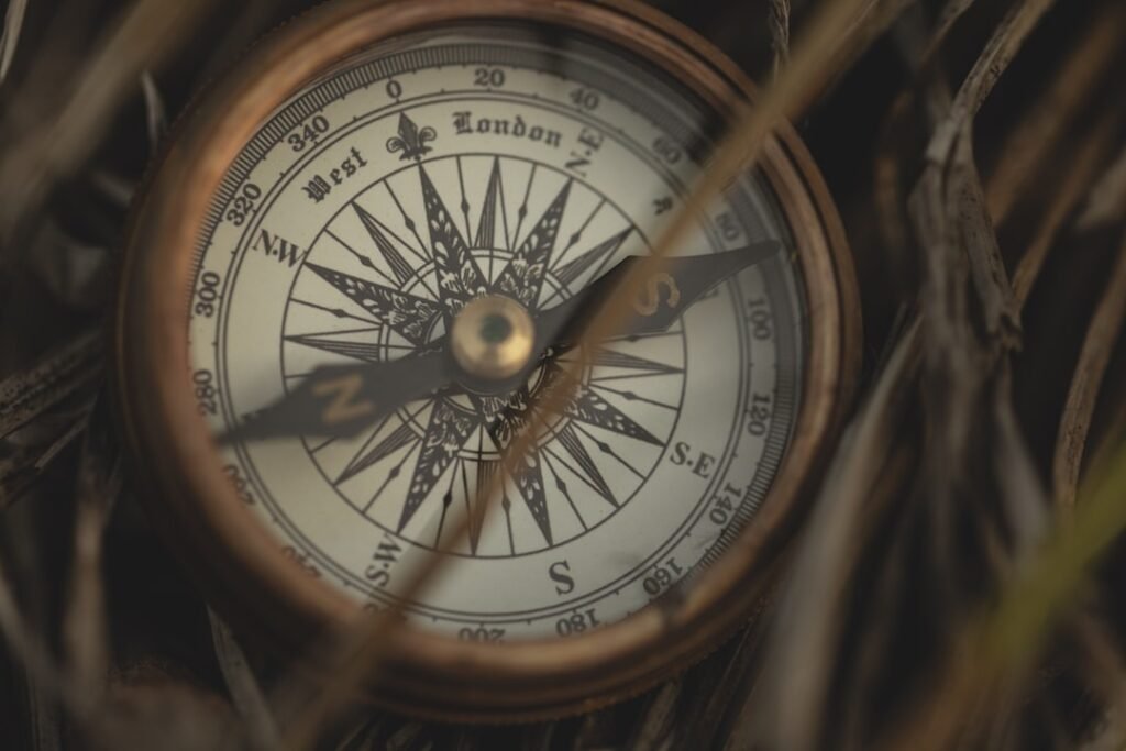
- Ancient mapmakers used tools such as compasses, astrolabes, and measuring instruments to create accurate maps.
- Mapmaking has evolved from papyrus scrolls and hand-drawn maps to digital GPS technology.
- Ancient maps provide insight into how early civilizations viewed and understood the world around them.
- Ancient maps continue to influence modern geography, navigation, and cultural preservation.
These early cartographers developed navigational aids based on their observations of the terrain, the stars, and trade routes. You will learn how maps were not only instruments for navigating but also representations of social structures and cultural beliefs as you study this history. Cartography’s development is linked to the advancement of human civilization, demonstrating how our knowledge of geography has influenced how we interact with the outside world.
Using scale was one of the most important methods because it enabled cartographers to depict land features proportionately. Because it made navigation & planning more precise, this idea was revolutionary. Ancient mapmakers also used legends and symbols to describe the land, resources, and settlements, which made their maps not only useful but also educational.
These early cartographers employed a wide range of instruments to match their methods. They used materials like clay, wood, and animal skins to create their maps, which may surprise you. The foundation for contemporary mapping, for example, was established by the ancient Greeks, who created a system of latitude and longitude.
| Map | Time Period | Region | Materials |
|---|---|---|---|
| Babylonian Map of the World | 6th century BCE | Mesopotamia | Clay tablet |
| Ptolemy’s World Map | 2nd century CE | Mediterranean region | Parchment |
| Tabula Rogeriana | 12th century | Islamic world | Parchment |
They were able to produce more accurate maps by measuring angles & distances with basic instruments like astrolabes & compasses. You will develop a greater understanding of the talent and imagination required to create maps long before the invention of contemporary technology as you investigate these antiquated methods and equipment. The introduction of new materials and technologies marked a major advancement in the mapmaking process. Tracing this evolution from papyrus scrolls to contemporary digital formats will show you how each development has changed how we view and engage with geography. Mapmaking was transformed in the Middle Ages with the invention of paper, which allowed for increased accuracy and detail.
Printed maps also became more popular during this time, increasing public access to cartographic knowledge. The creation of Global Positioning Systems (GPS) and Geographic Information Systems (GIS) in recent decades has further transformed mapmaking. Real-time navigation and data analysis have been made possible by these technologies, giving you the ability to travel the world with previously unheard-of accuracy. Think about how each development has affected our comprehension of space & place in a world that is becoming more interconnected, in addition to altering the instruments of cartography.
Examining ancient maps allows you to see into the minds of the people who made them, not just geographical representations. Ancient cartographers had a worldview that was influenced by their cultural knowledge, experiences, & beliefs. In order to show how spirituality & their perception of the physical world were intertwined, many early maps included religious symbols or mythological creatures alongside geographic features. Think about how these ancient viewpoints represent the priorities & ideals of their respective societies as you investigate them.
Ancient Greek Ptolemaic maps prioritized a geocentric conception of the cosmos, but medieval European maps frequently positioned Jerusalem at the center, emphasizing its importance in Christian theology. Knowing these points of view allows you to appreciate how ancient mapmakers not only depicted the physical landscapes but also the cultural narratives that influenced the identities of their communities. The influence of ancient maps on contemporary geography is extensive and significant. As you examine these historical relics, you’ll see that many modern mapping concepts have their origins in antiquated methods. The earliest cartographic innovations can be linked to the use of scale, symbols, & legends in contemporary maps.
Ancient maps also paved the way for exploration and colonization, influencing territorial claims and trade routes that still influence world events today. Modern navigation systems have also been permanently impacted by ancient navigational methods. Today’s GPS technology, which uses satellite positioning to direct travelers over great distances, is reminiscent of the celestial navigation techniques employed by ancient mariners. As you think about this influence, think about how knowledge of the past can help us approach geography & navigation in the present & the future.
For generations to preserve and exchange cultural knowledge, ancient maps were essential. You will learn as you study this area of cartography that these maps were frequently used as databases of data regarding local customs, agricultural methods, and trade routes. By shedding light on how societies interacted with one another and their surroundings, they promoted a feeling of identity and community. Rather than representing individual viewpoints, ancient maps were frequently produced cooperatively within communities. This collaborative strategy made sure that important knowledge was transmitted from one generation to the next, enabling subsequent societies to expand on the knowledge of their forebears.
By encouraging inclusivity and representation in geographic narratives, contemporary mapping techniques can carry on this tradition as you reflect on this function in conserving cultural knowledge. Ancient maps are extremely valuable artifacts for archaeology and museum research. You are seeing concrete ties to earlier civilizations when you come across these historical records in museums or archaeological sites. Each map provides insightful information about the cultures of its creators by narrating their lives, convictions, and goals. Ancient maps can reveal information about settlement patterns, trade networks, and environmental changes over time in archaeological contexts.
For scholars attempting to reconstruct past landscapes and comprehend how people interact with their surroundings, they act as primary sources. When you interact with these artifacts in academic or museum settings, think about how they advance our shared knowledge of geography and history.
In order to make historical maps accessible to a worldwide audience, digitization efforts are being made as technology develops.
Access to rare cartographic treasures from any location in the world is made possible by the digital revolution, which deepens our understanding of our common history. Also, interactive experiences made possible by digital platforms improve your comprehension of historical maps. Layered historical data and current geographic data can be explored together, giving your investigation a richer context. As you embrace these developments in digital preservation, think about how they can encourage future generations to learn about the art & science of cartography and democratize access to knowledge.
To sum up, your exploration of the history of cartography reveals a diverse tapestry woven from cultural expression, human experience, and inventiveness. Mapmaking has changed from antiquated methods to contemporary technologies, but it has always been firmly anchored in our need to comprehend the world. Remember that every map is a reflection of the people who made it as well as a depiction of space as you continue to delve deeper into this intriguing field. This is evidence of our never-ending pursuit of understanding and connection.
If you are interested in old maps, you may also enjoy reading about famous historical figures who have shaped the world we live in today. Check out the article on history.vahub.ai to learn more about influential individuals throughout history and their impact on society. Additionally, you can explore their blog at history.vahub.ai/blog for more in-depth analysis and insights into the lives of these remarkable figures.
FAQs
What are old maps?
Old maps are historical documents that depict geographical features, landmarks, and boundaries of a specific area at a particular point in time. They are often used to study the evolution of landscapes, urban development, and changes in political boundaries.
How old are old maps?
Old maps can range from a few decades to several centuries old, depending on the specific map and its historical context. Some of the oldest surviving maps date back to ancient civilizations such as the Babylonians, Greeks, and Romans.
What information can be found on old maps?
Old maps typically include details such as topography, rivers, roads, cities, and political boundaries. They may also feature illustrations of landmarks, cartouches, and decorative elements that provide insight into the cultural and artistic styles of the time period.
How are old maps used today?
Old maps are used for a variety of purposes, including historical research, genealogy, urban planning, and environmental studies. They can also be valuable for understanding the cultural and political context of a specific time and place.
Where can I find old maps?
Old maps can be found in libraries, archives, museums, and online repositories. Many institutions have digitized their collections, making it easier for researchers and the general public to access and study these historical documents.